
DJI, has launched a new tool called the Zenmuse L3. This new device attaches to certain DJI drones and combines a laser sensor for measuring distances with two high-quality color cameras. It will help professionals create detailed maps and 3D models of large areas quickly and accurately. The Zenmuse L3 is designed for jobs like planning roads, checking forests, or inspecting power lines, and it starts shipping later this month.
The Zenmuse L3 is DJI’s latest step in making advanced surveying tools easier to use. It builds on earlier models like the L1 and L2 but goes further with better range and sharper images. The main laser part, called LiDAR, sends out invisible light beams to measure shapes and heights from far away.
It can reach up to 950 meters even on dark or low-reflective surfaces, like tree trunks or rocks, and it works well in bright sunlight. This means it can see through leaves or grass to get a clear picture of the ground below.
What makes the L3 special is its pair of 100-megapixel color cameras. These capture full-color photos at the same time as the laser scans, covering a wide view of up to 107 degrees side to side. The cameras use large sensors that work great in low light, and they can combine pixels to make even clearer images.
Together, the laser and cameras let you make things like flat overhead maps, 3D height models, or colorful point clouds—all from one drone flight. For example, at a height of 300 meters, a single trip can map 10 square kilometers, and a full day’s work could cover 100 square kilometers.
The device also has a built-in positioning system that keeps track of where the drone is and how it’s tilted, making the data super accurate—down to a few centimeters. It fits right onto the DJI Matrice 400 drone, which is built for tough jobs.
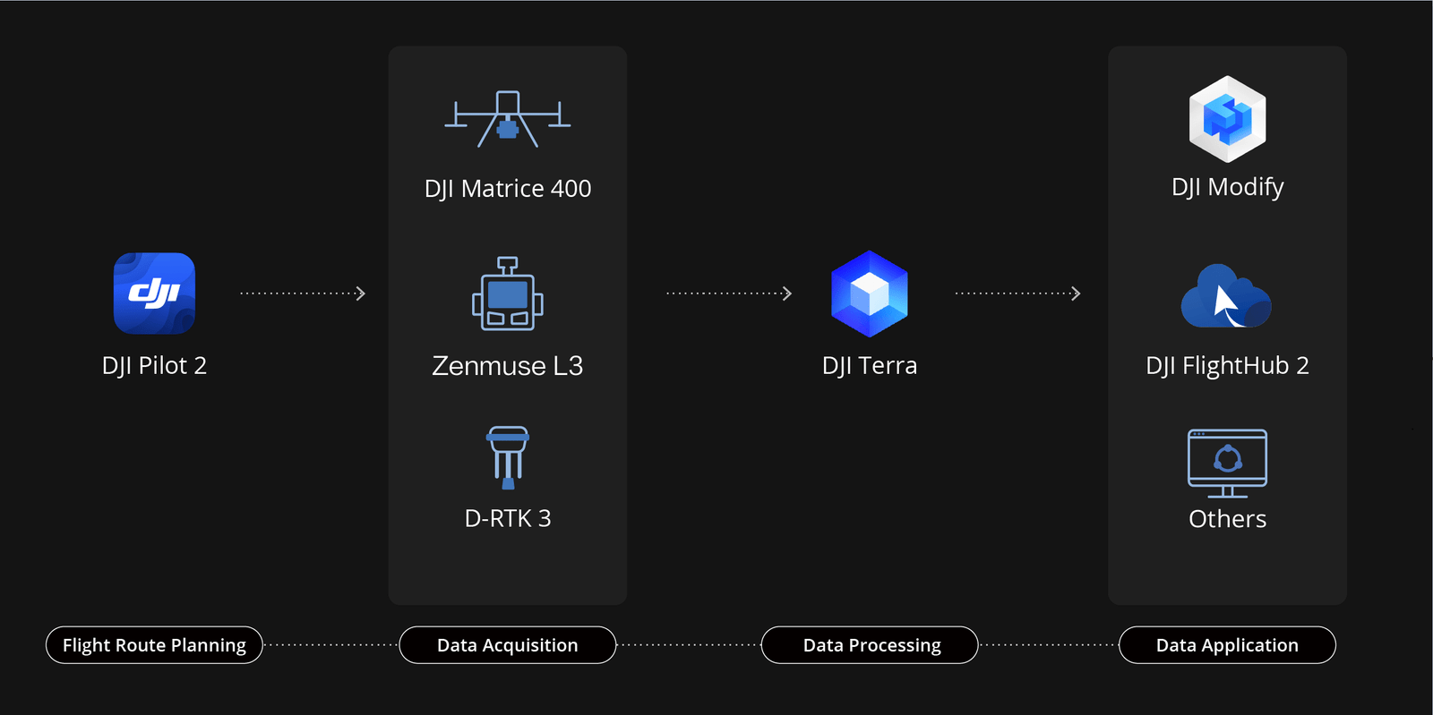
To make everything even better, DJI pairs the L3 with tools like the D-RTK 3 base station for extra precise location info and software called DJI Terra and DJI Modify. These programs turn the raw data into easy-to-use maps or 3D views, and they can even create new kinds of models like Gaussian Splatting for realistic scenes.
DJI says the Zenmuse L3 is perfect for a range of tasks. In forestry, it can measure tree heights and spot diseased areas without touching the ground. For city planning, it helps create detailed models of buildings and roads.
Emergency teams can use it to map disaster zones quickly, and energy companies can check power lines for damage from afar. The laser can pick up multiple “returns” from a single beam—up to 16 layers—so it handles thick plants or uneven terrain without missing spots.
Priced around $8,000 (not including tax), the L3 is much cheaper than similar tools from other brands that can cost over $150,000. It weighs about 1.8 kilograms and is built tough for outdoor use, with a three-axis stabilizer to keep scans steady even in wind. DJI plans to release it worldwide in late November, with full support for their enterprise software updates.


